Buxton Half Marathon
- Running
- Half Marathon
Buxton, Derbyshire, England, United Kingdom

Event lasts 4 hours 15 minutes.
Join us for a fun navigation challenge (all map reading abilities welcome) in the picturesque Goyt Valley as we seek out the elusive Joe Brown's numbers.
Joe Brown was a highly regarded rock climber and mountaineer in post-war Britain and the first person to scale Kangchenjunga - the 3rd highest mountain in the world. In the 60s, he worked at the White Hall Outdoor Centre just north of Buxton, during which time he carved coordinates in stone walls and rocks around the Goyt Valley, each number giving the location of the next.
Each set of numbers gives either a 6 digit grid reference or a compass bearing and distance to locate the next number. Many are hidden in some quite sneaky places and some are quite badly eroded. If completed in one go, the route would measure approximately 19 miles with 3,400ft ascent. Finding The Fells is splitting the challenge into two guided runs measuring approximately 8 and 11 miles with 1,200ft and 2,000ft elevation respectively. It's not mandatory to do both runs (ticket on this page is for the first 8.5 mile outing only). Runners are welcome to come on one or both runs. Each will cover the same range of skills, merely on different terrain/areas of the Goyt Valley.
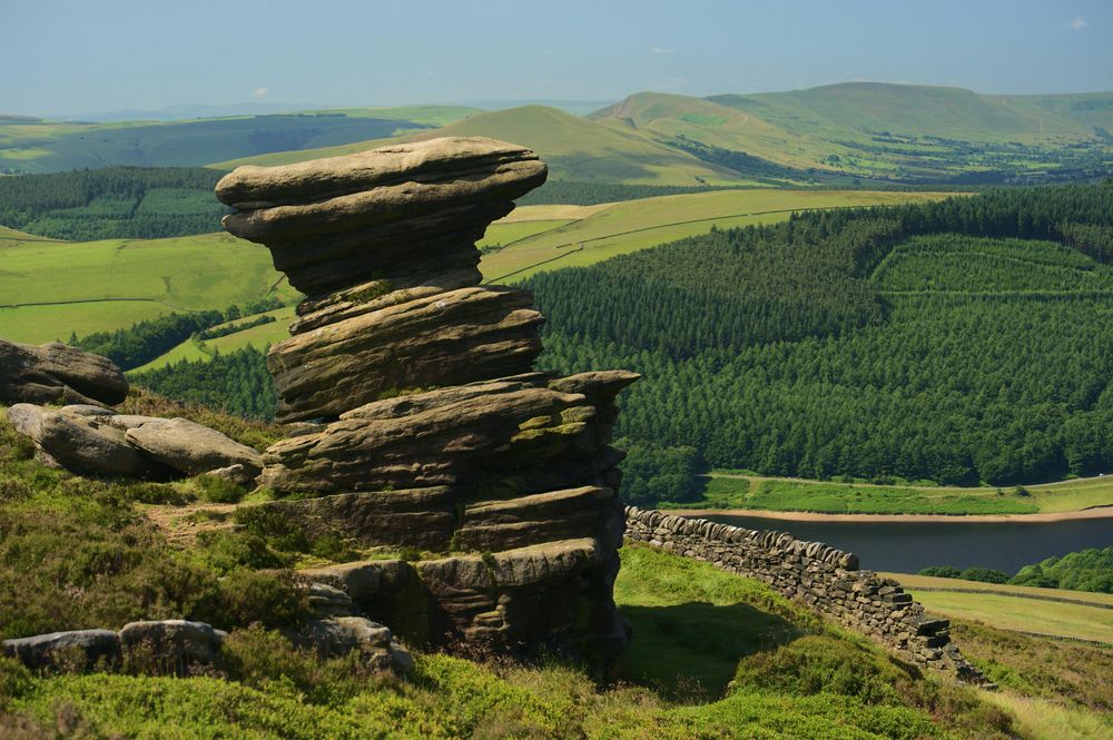
Just northwest of Buxton, Goyt Valley boasts a beautifully varied landscape. Nestled between the moorland of Shining Tor and Burbage Edge to the south; with the rocky crags of Windgather Rocks and the woodland paths surrounding the reservoirs further north. It's a great area for trail running with a plethora of routes from easy to challenging.
These two navigation focused runs are ideal for those with little to no map reading experience as well as those who want to brush up on their skills. You'll learn to:
Both the 8 mile and the 11 mile routes mostly keep to paths (from hard packed gravel to some which can be quite slippery and muddy depending on recent rainfall) and both routes do have some short sections leaving well-trodden paths to access some of the carved numbers. Grippy shoes are a must!
If you can manage a 5k parkrun comfortably you should be fine on this event. The pace will be gentle with plenty of pausing to search for the carved numbers, admire the views, and discuss details on the map. Expect a very steady outing with lots of stopping and short sections of running. Newcomers to trail running are more than welcome.
8.5 miles / 1,200ft
Off-road/grippy running shoes essential, along with buff, waterproof jacket, snacks, water, and any personal meds and running pack. Extra long sleeve layer and hat/gloves advised. Maps and compasses are provided (at no cost).
Meeting at 8:45am – plentiful parking. Meeting just outside the car park at the T junction of The Street and Goyt Lane.
///consults.earth.courage
| General Admission | £25.00 | See |
Help us keep everything accurate. Report any issues with this event.